Taoiseach Enda Kenny has apologised for not visiting some of the areas worst hit by recent flooding in the aftermath of Storm Desmond.
In an interview on Mid West Radio on Wednesday, Mr Kenny said he felt it was more important, for now, to remain in Dublin from where the response was being coordinated. He said he would visit affected communities at some stage in the future.
Questioned specifically about the situation in Crossmolina, in his home constituency of Mayo, he said Minister of State for the Office of Public Works Simon Harris would visit the town during Christmas week to discuss designs for flood relief works with the community.

With further rainfall anticipated over the coming days, residents and businesses have been warned water levels along the lower River Shannon are due to rise further.
Many areas of the country remain flooded in the wake of Storm Desmond. Severe floods remain a risk over the weekend in some areas, the national group co-ordinating the response to the floods said on Wednesday.
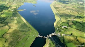
While it noted the ESB had decided against increasing the discharge level at the Parteen Weir, Limerick City and County Council said water levels along the river were continuing to rise and that they could elevate further during the next few days.
Council staff, assisted by members of the Defence Forces, are continuing to implement flood defence measures along the river bank.
The National Co-ordination Group responsible for handling the national response to the flooding and effects of the adverse weather conditions around the country met on Wednesday morning.
Chairman Sean Hogan said things were improving in many areas and water levels had stabilised in a number of rivers, and were falling in others, including some which were flooded at the weekend.
“We still have one stretch of river which remains at risk and about which we are concerned and that’s the lower and middle Shannon catchment, where water levels continue to rise steadily as the rain from last weekend makes its way down the country to drain out to the sea in Limerick.
“However, some Shannon tributary levels are falling and this will bring relief in some areas which have been under threat already in the Shannon area.”
The situation was being managed by the OPW and ESB Generation in consultation with local authorities, Mr Hogan said.
Army
The Defence Forces were also involved in trying to protect property and defend it from flooding. He said, however, that as the water kept rising it was not possible to protect all properties as water was seeping around sandbags.
“Properties remain under threat, despite knowing which areas are at risk.”
Jim Casey of the Office of Public Works said that in the past day or so, since 6am on Tuesday up until 9am on Wednesday, all the gauges on the main River Shannon had indicated a rise, with the largest of about 3 inches being in Athlone.
Levels had risen by about an inch in the lower catchment area.
“We are looking at severe floods, potentially.”
Mr Casey said those places that were vulnerable to flooding would likely be affected. The local authorities knew where those places were and were best placed to give advice.
Mr Casey said the best assessment was that flood levels would peak in the lower Shannon catchment from Lough Derg down to Limerick city on Sunday and Monday.
“I would stress as well that the levels we are seeing and expect to see later today will get into the severe flood threshold, in or around the 20-year return period threshold and going up from there.”
Mr Casey said this referred to the flows on the river system as opposed to rainfall intensities.
It did not mean a one in 20-year event. “It’s just an indicative level of flood intensity. You could indeed have a similar event in a month’s time, for example.”
He said it was not possible to say how this would manifest itself, but he believed it would “peak out” on Sunday and Monday.
Westmeath
Westmeath County Council said water levels in the River Shannon were continuing to rise slowly and were being monitored.
The council has activated its flood emergency response plan and a meeting of the inte-ragency response committee is held each day at 11am.
Lieutenant Colonel Kevin Campion of the Defence Forces said there were personnel in Ballinasloe and Athlone continuously in recent days to assist the response to the flooding. Troops had also been deployed in Clare in the early hours of Wednesday.
He said the Defence Forces remained on standby and remained available to assist national efforts.
Weather
Meteorologist Evelyn Cusack of Met Éireann said there were status 'yellow' weather warnings out since Tuesday evening for winds, gales and a spell of heavy rain up to later on Wednesday.
She said there was a degree of uncertainty about the weekend forecast. What looked most likely was that there was a chance of some heavy rain in the south of Munster, in parts of Kerry, Cork, Waterford and perhaps into south Wexford.
There was a “definite high risk of some very wet and very windy spells for Sunday and our medium range which is up to next week”.
Separately, the Government has also agreed in principle to establish a new weather forecasting system at a cost of €2.5 million and involving the recruitment of 15 new staff for Met Éireann.


