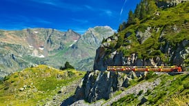
It sounded like a good idea at the time. Sitting at a shaded bar in Mijas Pueblo, the Andalucian town on the Costa del Sol, basking in the September warmth of the Spanish sun, and slurping the dregs of what might have been our second cocktail, we decided to stop just looking at the town’s mountain range – one of the most verdant areas of the Costa del Sol – and book a return trip for a November hillwalking trip. No way would we laze and graze this time – we would leave behind our swimming pool stuff and flip-flops and pack our walking boots. We also knew we wouldn’t be sweating – the average daily temperatures for Mijas in late November were 17-18 degrees, a bit nippy for the locals but by Irish standards luxuriously warm for the time of year.
We have four nights and three full days, the first two of which we earmark for hillwalking. We’re staying in a boutique hotel in the town centre and we time our breakfast to ensure we are at the starting point by 11.30am. During our previous summer visit, we obtained the Sierra de Mijas walking map from the town’s tourism office, so we have a good idea of which signposted (and self-guided) trails to take.
We haven’t a notion, however, of how challenging the trails will be. It’s all very well to keep an eye out for the abundance of botanical varieties that cover the area and clusters of cabra montés (mountain goats) that roam freely, but we don’t fully understand that the map’s mentions of “geological peculiarities” and “rugged terrain” will almost prove our undoing.
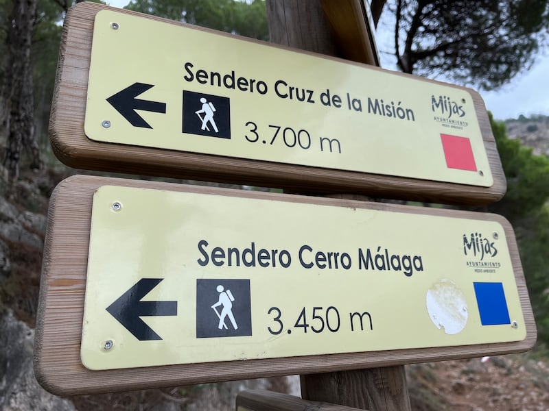
Because of the time constraints, we decide to keep the trails to four hours maximum from start to end. The sun takes cover around 6pm, and this will give us, we assume, plenty of time to negotiate the trails, take a breather, and return to the hotel in time for a shower and dinner. We start the first day of hiking on the Mission Cross Route (Ruta Cruz de la Misión, aka the Red Route). It’s a walk of 3.2km with an elevation of 525m. This is noted on the walking map as a “challenging” route, and how right that is. From the very start (El Mirador de Mijas Pueblo/Mijas town viewpoint) the gradient is ridiculously steep – even the steps leading up from the start point to the beginning of the mountain trail are demanding.
RM Block


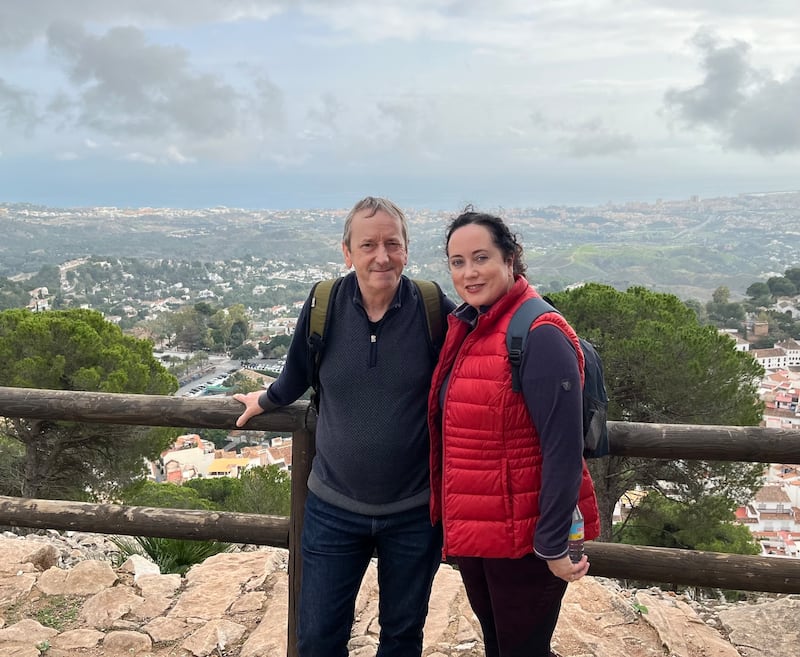
We realise all too soon that this will not be a gentle amble along slowly unfolding hills (missing you already, Lake District) but rather a delicate negotiation between deep-breath inclines and loose, rocky, often abstractedly planned paths. We stop for a water break at the whitewashed Ermita del Calvario (Calvary Shrine), which dates from 1710 and was once a place of spiritual retirement for the order of the barefoot Carmelite brothers. We have our photo taken by a fellow hillwalker, take in the impressive views over the Mediterranean, and continue along the nominal path to an elevation of almost 600m.
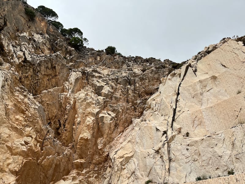
We agree we could persevere until we reach Puerto Colorado, but we didn’t get to where we are today by looking potential pain in the face and embracing it, so we backtrack to the point on the trail that leads to the Cantera del Barrio, a long-disused marble quarry that dates back more than 2,000 years. The descent here is tricky enough, with sharp stones and scrabble paths that eventually make their way to a concrete track leading to the main road towards Mijas.
Crossing the road, we come to the elevated level of the town, where people with more sense than us are getting on with their day in a more relaxed manner. It doesn’t seem to make sense to walk into Mijas along the path by the motorway, so we ask a passerby if there are any shortcuts. He points towards a gap between two houses and says, “Walk down.”
So begins a sequence of vertiginous steps to the town. This is easy enough on the way down, but how on earth do homeowners and residents manage with shopping bags, buggies and babies on the way up? Eventually, we reach Mijas and walk to the nearest bar. We had thought we’d cover more ground on the first day but are invigorated enough to cut our losses, calculate the steps (almost 14,000 – and hard-won they were, too), and rest awhile with a couple of beers.
Day two. It’s up and out to tackle the Yellow Route (Sendero Circular Ermita del Calvario), a walk of 4.1km, with an elevation of almost 800m. Starting at the same access point, we climb eastward towards the Cañada (ravine) Gertrudis. This is another steep hike with a gradient of almost 300m and is just as difficult to negotiate (if not more so because our calves are feeling the demands of the previous day). The slopes zig and zag for a good portion of the ascent, and for a time it feels like we are participants in Squid Game, on our way to a sticky end.
We stop regularly to sip water and look out at bird’s-eye views of the beautiful coastal strip between Benalmádena and Marbella. Today, the sky is somewhat hazy, so we can’t see the Rock of Gibraltar or the highest of the North African mountains. We venture further. With some effort, we reach the trail’s high point. The ground along this section is tough, with tree roots jutting out and large rocks breaking through the earth. Further on, the so-called path isn’t that at all but a collection of stepped, jagged rocks that are increasingly difficult to walk on.
It’s fair to say we are feeling the strain, but the sense of achievement when we reach the 800m mark is enhanced by the knowledge that likening this to any hill walks or hikes we have done in either Ireland, the UK, or other parts of Europe is pointless. There is nothing mild about the walking routes of the Sierra de Mijas; rather, they are a test of stamina and endurance. As we make our way down towards the town, we have to be careful not to be complacent. Yes, we reckon we have passed the test, but put one foot wrong before we reach level ground and we could end up with, at worst, a broken ankle or, at best, ripped skin on a leg or hip.
We reach the town, fatigued yet buzzing. Salvation is at hand. We walk to our favourite restaurant, Pampa Tablas y Tapas, on the Virgen de la Peña, sit down, check our fitness apps (over 15,000 steps) and ask for – yes, why not? – the cocktail menu.
Tips for walkers
Maps: Plan your route. Maps are available from Mijas Tourism or via downloadable PDFs from alltrails.com
Weather: Choose a day with decent weather. We were advised by Mijas Tourism not to tackle the trails in July or August (there is little or no shade on the trails) or if it has been raining.
What to pack: Sturdy walking boots are key to withstanding the rigours of these trails – they are not for the casual walker. Pack light, with water and energy snacks (there are no pop-up cafes). Wear appropriate clothing (long hiking pants or leggings to prevent scratches from spiky plants/flora). Make sure mobile phones are fully charged before setting out. Carry a basic first-aid kit.
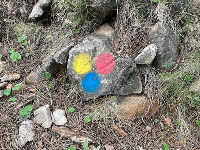
The Trails: Think moderate to difficult. Due to the steep inclines, try to synchronise breathing with your steps to prevent untimely fatigue. More often than not, you will need to keep your eyes on the ground to avoid the constant hardscrabble and stones that lie in wait. We encountered very few hillwalkers (and no families) on the trails we undertook, and those we did seemed experienced enough. The colour-designated trails/routes are clearly marked.
Finally: Always tell someone which route/s you intend to take and your estimated time of return. Leave nothing behind but your footprints.